Yellow Creek
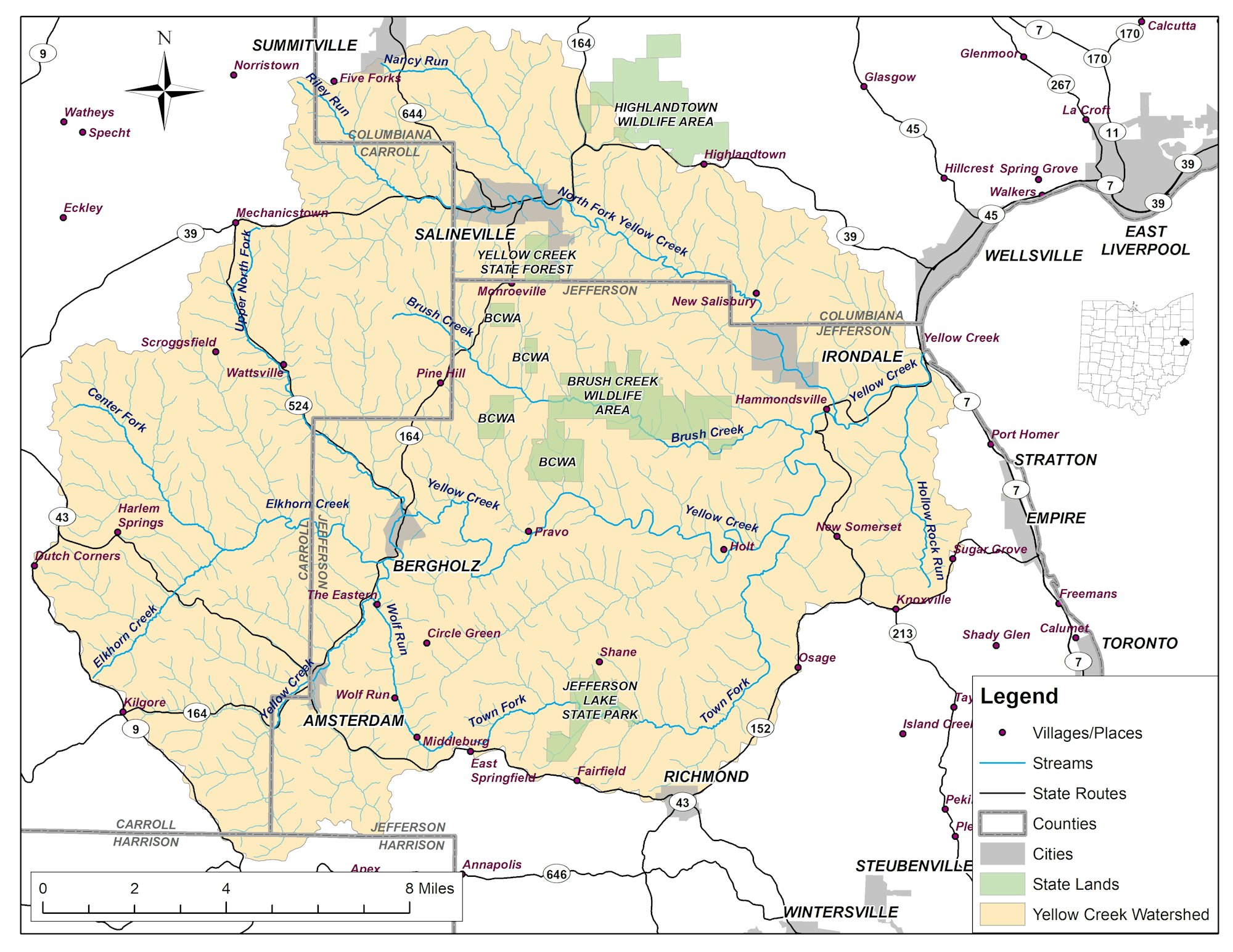
Yellow Creek is located in Carroll, Columbiana, and Jefferson Counties in eastern Ohio, draining 239 square miles with an average fall of 18 feet per mile. The creek enters the Ohio River at about river approximately one half mile downstream from Wellsville. The highest point in the watershed is 1,300 feet above sea level and the mouth is at 654 feet. The land in this watershed is dominated by forested areas.
Yellow Creek has been designated as a priority watershed for restoration, with several known causes of impairment and high levels of bacteria. These impairments and their sources include: failing home sewage treatment systems, cattle access to streams, eutrophication from lakes, acid mine drainage, sedimentation contributed by ATV use, and lack of sewer treatment systems in incorporated areas.
Acid mine drainage (AMD) comes from abandoned underground mines and un-reclaimed surface mines in the area. Yellow Creek also suffers from high levels of bacteria in the water.
These goals will be reached by the installation of BMPs, and restoration projects specific to issues such as sedimentation, acid mine drainage, etc.
The Ohio Environmental Protection Agency has recently studied the water quality in Yellow Creek. The resulting biological and water quality reports for Yellow Creek can be found below: